3DHP Program
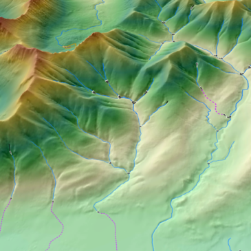
As the USGS has invested significantly over the years in the 3D Elevation Program (3DEP) initiative that provides high-quality aerial lidar-based topographic data and a wide range of other three-dimensional representations of the nation’s natural and constructed features, the USGS is now leveraging that 3DEP investment to further utilize that existing lidar data to derive updated and higher accuracy hydrography as part of the USGS 3D National Topography Model (3DNTM).
The USGS 3D National Topography Model (3DNTM) initiative integrates USGS lidar-based elevation and hydrography datasets to model the Nation’s topography in 3D. The 3D Hydrography Program (3DHP) is the hydrography component of the 3DNTM. The 3DHP Data Collaboration Announcement (DCA) process will result in the addition of public domain 3DHP hydrography data derived from existing 3DEP lidar data for the 3DNTM obtained through collaboration between the USGS and a broad range of partners.
Applicants may submit a 3DHP DCA application to the USGS for matching funding consideration toward conducting a 3DHP project managed by USGS via the Geospatial Products and Services Contracts (GPSC) or they may request 3DHP funds via cooperative agreement toward a 3DHP elevation-derived hydrography project where the requesting partner is the acquiring authority and manages the project. Federal agencies, State and local governments, tribes, academic institutions, and the private sector are eligible to submit proposals.
The Merrick-Surdex JV has assisted multiple state/local government agencies with 3DHP collaborations that culminated in the successful award of USGS grants for higher accuracy hydrography derived from existing 3DEP lidar data.
